
Map Generator
The Map Generator turns a new fantasy landscape or an imported Azgaar map into cells and places for your game.
Start with the places your game needs
The Map Generator creates the ground your characters will travel across. Shape a new fantasy landscape or bring an existing Azgaar world into Davia, then continue in the Creation Hub to add people, conflicts, stats, and rules.
Our Map Generator is inspired by Azgaar’s Fantasy Map Generator. We thank Azgaar and the project’s contributors for their work.
From Creations, select New Game, then Map Generator. Choose World map instead if your game takes place on Earth; Your first game follows that path.
Give the map a name. Drag to move, scroll to zoom, and right-drag to orbit. Center map brings the whole landscape back into view.
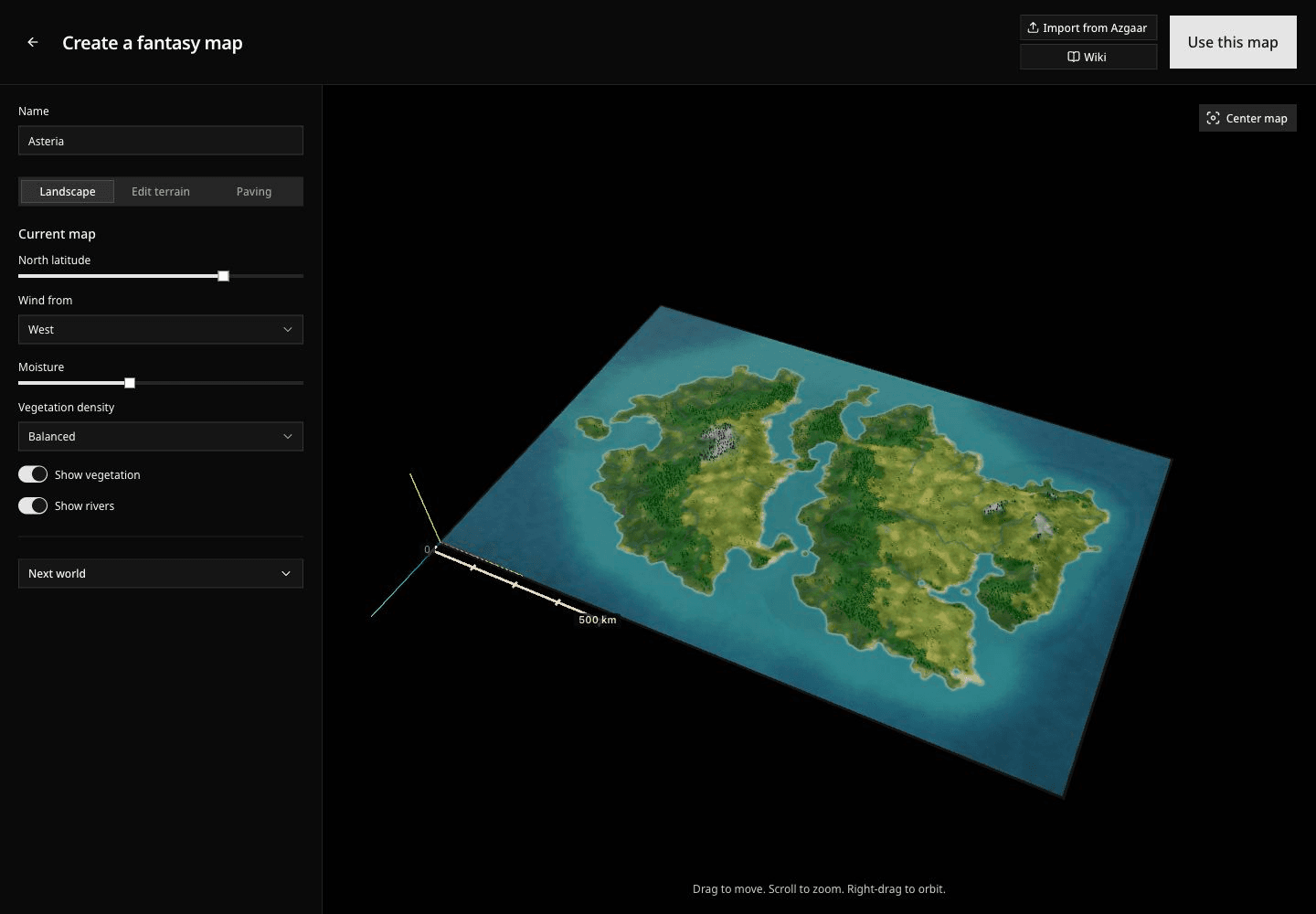
Shape the landscape
In Landscape, the Current map controls adjust latitude, wind, moisture, and vegetation. You can also show or hide vegetation and rivers while inspecting the world.
For a different geography, expand Next world. Choose a World shape, adjust Land coverage, and set World width (km). Select Generate world, then confirm. These settings create a replacement world; changing its width here does not resize the landscape already on screen.
Generating another world replaces the current landscape, terrain edits, and paving. Finish exploring alternatives before spending time on detailed edits.
In Edit terrain, use Flatten or Smooth with the brush size and strength controls, then drag over the landscape. These brushes preserve coasts and riverbeds. Undo removes the last brush stroke. To change a shoreline, choose Edit coast and drag a coastal point.
Turn the landscape into cells
Paving divides the map into fixed cells, called territories in the workshop. These are the areas that carry location-based stats during play. A mountain, coastline, or political color is not itself a cell.
- Open Paving and enable Show proposed paving.
- Choose the number of Territories, then select Apply paving.
- Click a territory to inspect its name. Naming culture changes the generated names without changing the landscape or borders.
Changing the cell count does not generate new islands or mountains. Choose enough cells to distinguish places that create different decisions for your characters, without dividing every stretch of countryside into its own problem to manage.
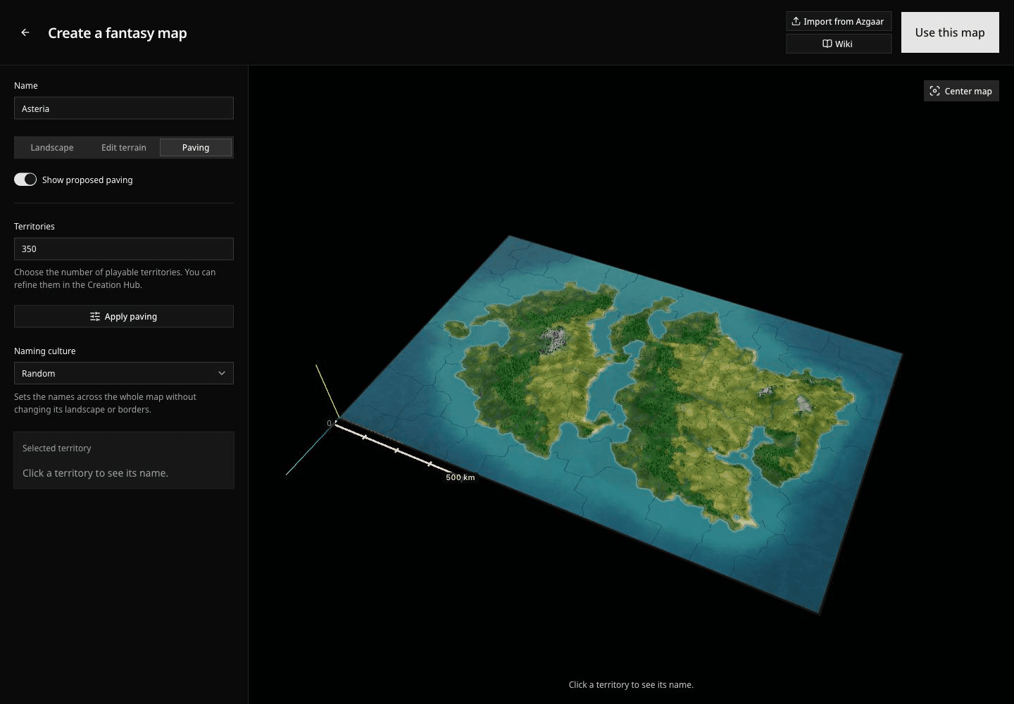
Political control can later change as a cell stat while the cell's shape stays fixed. Designing the world explains how cells, mobile entities, and fixed landmarks work together.
Bring an Azgaar world
If you already have a world in Azgaar's Fantasy Map Generator, use its native .map save, up to 64 MB. An exported image or SVG does not contain the complete data needed for this import.
- Select Import from Azgaar and choose the file.
- Select Check map. Davia checks the file and prepares its playable territories.
- When the check succeeds, choose what to keep, then select Import this map.
Checking the file does not replace your current landscape. Confirming the import does. If a file cannot be read, cancel or try another complete native save.
| Element | What appears in Davia |
|---|---|
| States | Always kept as a cell stat, with their names and colors. |
| Towns | Optional landmarks at the original town locations. |
| Population | Optional population values on cells and on any imported town landmarks. |
| Religions | Optional cell stat for each territory's dominant religion, with its original colors. |
Towns and population are selected initially; religions are not. You can keep population without importing town landmarks. A cell's population includes its towns, so adding the cell and landmark values together would count those inhabitants twice.
Only information present in the file can be kept. Selecting religions in a file without religious data does not create that stat. Unrecognized color fills use neutral gray.
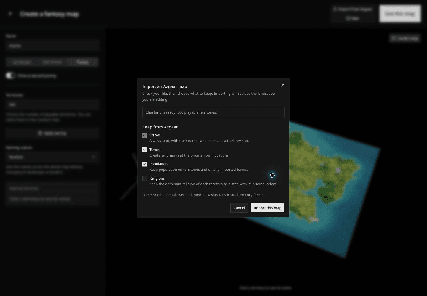
Cells, names, and relief
The import starts with a target of 500 playable cells, within a supported range of 200–500. It groups smaller Azgaar cells, preserving state boundaries and using provinces where possible. Province and town names help name the resulting cells. A large province can span several cells; several smaller provinces within one state can share a cell.
Imported province and town names take priority over the generated names from Naming culture.
The final count can differ from the target. If the map cannot fit the supported range while preserving its required boundaries, the import is rejected. The landscape also adapts relief to Davia's terrain: expect your world's geography and places, rather than an exact copy of Azgaar's illustrated map style.
Scale and positions
Davia reads the distance scale saved in the Azgaar file and converts recognized units to kilometers. The imported world width is limited to 1–6,400 km. An unknown custom unit uses a default width of 1,600 km; for a predictable result, save the Azgaar map with kilometers before importing it.
Towns keep their relative positions and are attached to the cells that contain them. Davia gives the fantasy map its own coordinates for locating places and movement; it does not retain Azgaar's original latitude and longitude as Earth coordinates.
Continue building the game
Select Use this map to save the map and open its draft in the Creation Hub. This step does not publish the game.
Inspect the cells, town landmarks, and imported stat layers. States arrive as stat values, not as playable characters or faction entities. Add the people and groups your game needs, then use the Game Stat Table and simulation rules to explain how the starting world can change.
You can also create with your assistant once the map is ready. Give a character a position, an immediate pressure, and something worth attempting before you move on to publication.